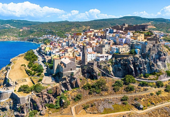
You could spend a week on Sardinia’s beaches and never run out of perfect sand. But the island has so much more waiting for you.
Drive the full loop and you trade the crowds for wind-carved granite, ancient ruins above the sea, medieval towns on hilltops, painted mountain villages, and cliffs hiding old mining tunnels.
Think of Sardinia as a small continent with its own languages, flavors, and history. Here is the route that shows you all of it. 😊
1. Olbia
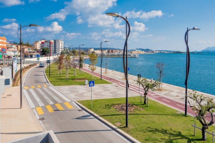
a. Your First Taste of Gallura
Most road trips start here, at a sheltered port busy since ancient times and easygoing enough to ease you into island life.
b. The Landmarks You Shouldn’t Rush Past
- The Basilica of San Simplicio, a grey-granite Romanesque church from the late 1000s, hiding a necropolis of more than 450 ancient burials beneath its floor
- The Church of San Paolo Apostolo, built over a Roman temple to Hercules and crowned with a bright majolica-tiled dome
- Castello di Pedres, a granite hilltop fortress from the early 1300s, with a tall square keep and sweeping views
- The National Archaeological Museum, shaped like a moored ship on the islet of Peddone, holding timbers from Roman vessels sunk in ancient raids
c. Gulf Views and Quiet Green Corners
- Parco Fausto Noce, a leafy park of native trees and streams in the heart of town
- The Padrongianus wetland just south, good for spotting herons and seasonal flamingos
- Any waterfront viewpoint looking out to Tavolara Island, the limestone giant on the horizon
d. Rolling Into the Costa Smeralda
Drive north and the flat coast rises into Gallura’s granite hills, with discreet villas announcing the island’s most glamorous shore.
2. Porto Cervo
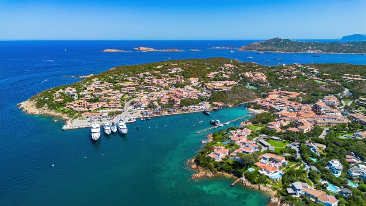
a. A Glamorous Town Built From Nothing
Planned in the early 1960s by Prince Karim Aga Khan IV, Porto Cervo was shaped in a soft, organic style called stile smeraldino, all rough granite, pastel plaster, and terracotta.
b. What to Enjoy Without a Yacht
- The Piazzetta, an open terrace of arcades, cafés, and boutiques above the old harbor
- The wooden Ponte Vecchio, an old footbridge tucked away from the busy streets, with calm views over the boats
- The Marina Nuova, one of the Mediterranean’s great deep-water yacht harbors and home to the Yacht Club Costa Smeralda, best watched over a coffee
c. The Church and Its Hidden Masterpiece
- The Church of Stella Maris, with white rounded walls and a porch on six huge granite pillars
- Inside, a Mater Dolorosa painting attributed to El Greco and bronze door reliefs of the Annunciation
d. The Coves Just Down the Coast
- Spiaggia del Principe, cupped in pink granite and juniper, long said to be the Aga Khan’s favorite
- Grande Pevero and Piccolo Pevero, with fine sand and clear, shallow water
Trust me, these coves are worth the short detour.
3. Palau
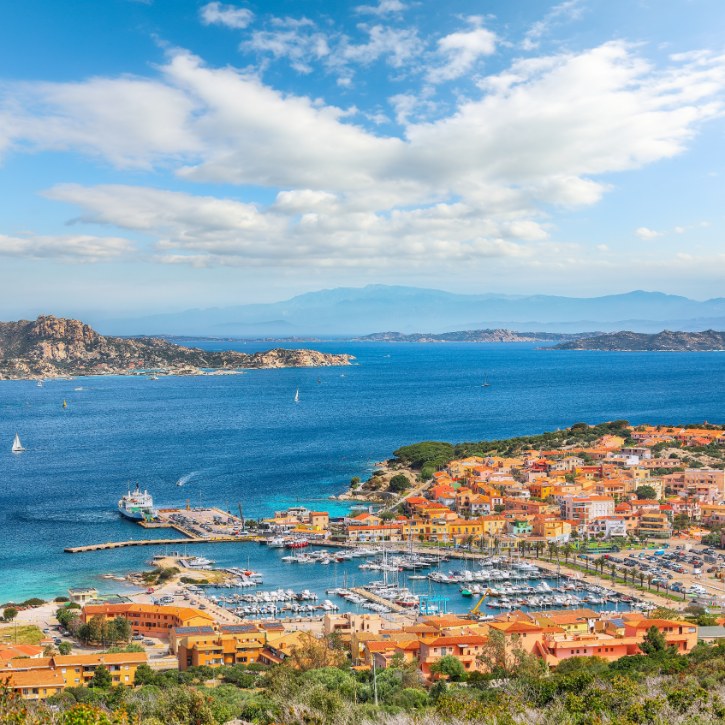
a. The Gateway to the Islands
Palau is your jumping-off point for the La Maddalena Archipelago, with a cheerful harbor promenade and plenty of good seafood.
b. Getting to the Protected Islands
- Ferries cross to La Maddalena island, which links by causeway to Caprera
- The outer islands like Spargi, Budelli, and Santa Maria are reachable only by boat
- The whole archipelago is protected, so its pale sands and clear water come with rules to respect
c. Bear Rock and a Bohemian Village
- Roccia dell’Orso (Bear Rock), a granite outcrop on a 122-meter headland at Capo d’Orso, shaped by wind into a crouching bear and noted by the geographer Ptolemy in the 2nd century AD
- Porto Rafael, a quiet village of whitewashed houses, bougainvillea, and a small square stepping down to a cove
- The Fortezza di Monte Altura, a 19th-century granite fort on the heights above, built to guard the approaches to the Strait of Bonifacio
d. A Step Back to the Bronze Age
- Nuraghe Luchìa, a stone tower and village on a rocky plateau
- The Tomba dei Giganti Li Mizzani, a Giants’ Tomb with a carved central stele
- The Tomba dei Giganti di Sajacciu, another megalithic tomb nearby
e. Pushing On to the Far North
West of Palau the land turns windswept, and you glimpse Corsica’s white cliffs across the Strait of Bonifacio.
4. Santa Teresa Gallura
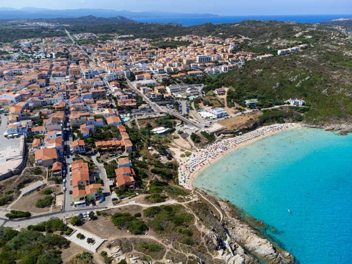
a. Standing at Sardinia’s Northern Edge
You are near the island’s northernmost point, Corsica just eleven nautical miles away, in a tidy town that grew as a border post.
b. The Tower With a View to Corsica
- The Torre di Longonsardo guards the harbor, a round granite watchtower built in the mid-1500s from the stones of an older medieval fortress
- Climb up for a clear line of sight across the strait to the white cliffs of Bonifacio, with old wartime lookouts dotting the nearby headlands
c. The Beach Right Below Town
- Fine white sand with soft pink streaks from crushed coral and shell
- Shallow, clear water sheltered between granite headlands
- Short paths leading to old wartime lookouts and open strait views
- One rule to follow: leave the sand where it is, as taking it is banned
d. The Wind-Carved Coast at Capo Testa
- Cala Spinosa, a rocky cove below the old lighthouse
- Valle della Luna, a hidden valley of giant boulders and springs, long loved by free-spirited travelers
- Roman granite quarries, where half-cut columns still lie abandoned in the rock
5. Castelsardo
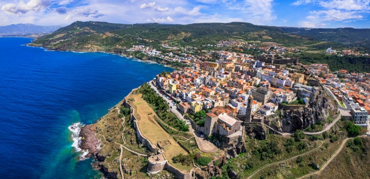
a. A Medieval Town on the Rock
Perched on a volcanic headland over the Gulf of Asinara, Castelsardo is a maze of stepped stone lanes and pastel houses with sea views at every turn.
b. A Living Craft You Can Watch
- Local women still weave baskets from dwarf palm, grass, and reeds
- It is one of Sardinia’s most authentic living crafts, worked right in the streets
c. The Landmarks That Make the Climb Worth It
- The Castello dei Doria, a 12th-century fortress holding a museum of Mediterranean weaving
- The Co-Cathedral of Sant’Antonio Abate, rebuilt in the late 1500s, with a colorful spire above the sea and a prized 15th-century altarpiece by the Master of Castelsardo
- Roccia dell’Elefante, an elephant-shaped rock outside town hiding two Neolithic tombs
d. Where to Dip Into the Sea
- Dark rocky coves break the shore below the citadel
- Lu Bagnu, the main swimming beach, has golden sand and shallow water a short drive southwest
e. Toward the Bright Shallows of the Northwest
The route curves past Porto Torres onto the Stintino peninsula, where cliffs melt into pale flats and glowing water.
6. La Pelosa (Stintino)
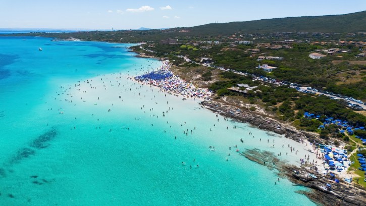
a. One of the Island’s Most Famous Beaches
Powder-white sand, water so shallow it shines turquoise, and a 16th-century tower on a little islet make La Pelosa the stuff of postcards.
b. How to Visit the Right Way
- Daily visitor numbers are capped, so book your spot online in advance
- Lay your towel on a rigid straw or bamboo mat, never straight on the sand
- Rinse off at the stations before you leave to keep sand from washing away
- Smoke only in the designated areas
c. The Village and Its Tuna Story
- Stintino was founded in 1885, when families were moved off nearby Asinara and rebuilt around two small harbors
- Its old life revolved around tuna fishing, a heritage told today at the local tuna museum, the MUT, through old boats, gear, and records
d. The Wild Island on the Horizon
- La Pelosa borders Asinara National Park, which covers the whole offshore island
- Once a prison, Asinara stayed wild and now shelters rare wildlife, including its famous white donkeys
- Admire it from the beach, but know that visiting means an authorized boat or ferry from Stintino
e. Heading for Catalan Alghero
South from the peninsula you cross open plains, then climb into limestone headlands as the towers of Alghero appear.
7. Alghero
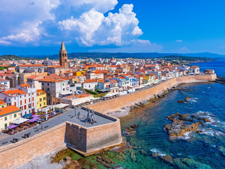
a. A Slice of Spain in Sardinia
After an Aragonese king took the city, its people were replaced with settlers from Catalonia and Valencia, and an old form of Catalan is still spoken on its bilingual streets.
b. Inside the Walled Old Town
- Intact sea walls ring the center, lined with old towers and bastions, several named for explorers like Marco Polo and Pigafetta
- The Cathedral of Santa Maria keeps its original Catalan Gothic octagonal bell tower
- Famous red coral, gathered from the offshore reefs of the Riviera del Corallo and worked into fine jewelry, with a museum to match
c. Sunset on the Sea Walls
- Walk Bastione Marco Polo at dusk for open sunsets over the sea, with Capo Caccia on the horizon
- Below the walls, the marina mixes fishing boats and pleasure craft
- The dish to order is aragosta alla catalana, a Catalan-style lobster
d. Big Nature on the Doorstep
- Capo Caccia, a limestone promontory rising nearly 180 meters from the sea, with griffon vultures nesting above
- Neptune’s Grotto, a huge sea cave of pools and stone formations, reached by boat or by a 654-step staircase carved into the cliff
- Maria Pia Beach, soft sand and dunes backed by junipers and pines closer to town
e. The Coast Road to Bosa
The drive south is one of the Mediterranean’s finest, hugging the edge where dark volcanic mountains plunge into the sea.
8. Bosa
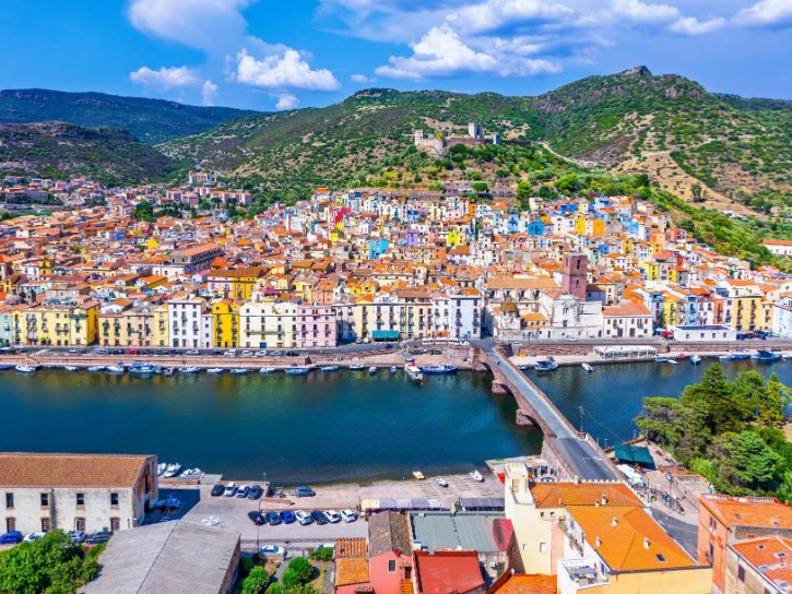
a. The Rainbow Town on the River
Bosa lines the Temo, the only navigable river in Sardinia, its tall pastel houses climbing the hill beneath an old castle that guards a chapel of medieval frescoes.
b. Wandering the Old Quarter
- Sa Costa, steep lanes and stone stairs where cars can’t follow
- Traditional lace and filigree crafts in the little workshops
- Sas Concìas, riverside tanneries from the days when Bosa was Italy’s leading leather town, now a museum
- Malvasia di Bosa, a golden dessert wine from the surrounding hills
c. Where to Find the Sand
- Bosa Marina, a wide beach at the river mouth, watched over by an old tower
- Cala Cumpultittu, a small cove of fine sand and pale rock
- Porto Alabe, known for its reddish sand and low cliffs
d. South Toward the Ancient World
The hills flatten toward the Sinis Peninsula, trading colorful streets for open country where the deep past takes over.
9. Tharros
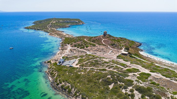
a. Two Thousand Years in a Single Place
Set on a narrow spit with harbors on both sides, Tharros stacks layer upon layer of history:
- A Bronze Age Nuragic village came first
- Phoenician traders founded the town around the 8th century BC
- Carthage took over and fortified it
- Rome conquered it and added roads, an aqueduct, and baths
- Pirate raids finally emptied it, and the capital moved inland
b. What to See Among the Ruins
- Original Roman streets, paved in dark basalt and grooved by ancient carts
- The Tophet, an open-air sanctuary of ancient urns on the hill above
- The Terme di Mare, Roman baths perched right over the shoreline, with their under-floor heating systems still visible
- The Tempio Tetrastilo, two slender Corinthian columns re-raised above the sea from original Roman pieces
- The high ground toward Capo San Marco for the best views
c. The Windswept Setting
- A protected marine area wraps the headland, scented with rosemary and sea fennel
- The ancient church of San Giovanni di Sinis stands nearby, one of the oldest Christian sites in Sardinia
- A coastal path leads past old quarries to the lighthouse
d. Toward the Mining Coast
Heading south, the farmland rises into limestone hills scarred with old rail cuts and mine shafts.
10. Porto Flavia
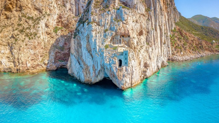
a. A Port Cut Straight Into the Cliff
Carved into limestone sea cliffs in the early 1920s, Porto Flavia was built by a mining company and named by its engineer after his daughter, Flavia.
b. How This Clever System Worked
- Two stacked tunnels, each about 600 meters long, bored through the cliff
- Nine tall silos carved between them, holding up to 10,000 tons of ore
- A conveyor that swung out through the cliff face, pouring ore straight into ships
- The payoff: loading dropped from weeks to a single day, and costs fell by more than 70 percent
c. The View From the Terrace
Step onto the cliff and you face the Pan di Zucchero, a limestone sea stack rising more than 130 meters from the water.
d. Getting the Heritage Right
- The site is now part of Sardinia’s historic mining park
- That mining park won UNESCO recognition within a global geoparks network
- Porto Flavia on its own is not a standalone UNESCO World Heritage Site
- Guided visits walk you through the tunnels, silos, and the old engineer’s office
e. Down to the Dunes of Chia
South from here, the towering cliffs give way to wide beaches and shallow lagoons.
11. Chia
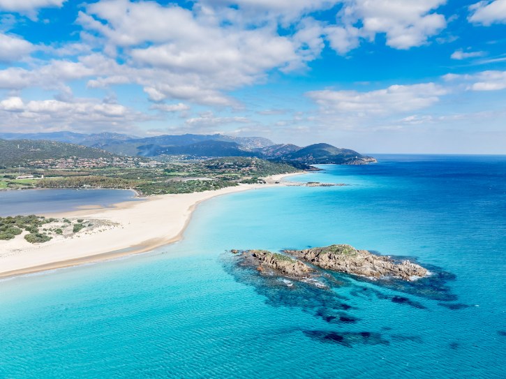
a. Beaches Behind the Dunes
Chia is all golden beaches backed by big sand dunes, some twenty meters tall and anchored by ancient junipers, with an open, unspoiled feel.
b. Knowing Which Beach Is Which
- Su Giudeu, a long sweep of fine sand with a granite islet about a hundred meters offshore you can wade out to
- Cala Cipolla, a sheltered cove ringed by pink granite and myrtle, with a path to a lighthouse
- Tuerredda, a little further west, a turquoise bay with a summer visitor cap managed by booking
c. Flamingos and an Ancient Tower
- Shallow lagoons behind the dunes are a key home for greater flamingos, known locally as “the red people”
- You can often watch them feeding just behind the beach
- The Torre di Chia stands on a 65-meter headland above the ruins of the ancient Phoenician-Roman town of Bithia, with views along the whole coast
d. A Coast Left Wild
- Development stays low-rise here, leaving plenty of open scrub scented with cistus, rosemary, and lavender
- Wooden boardwalks guide you to the sand, so stick to them and help protect the dunes
e. On to the Capital
The road east passes ancient ruins and salt ponds dotted with flamingos before opening onto Cagliari’s plain.
12. Cagliari
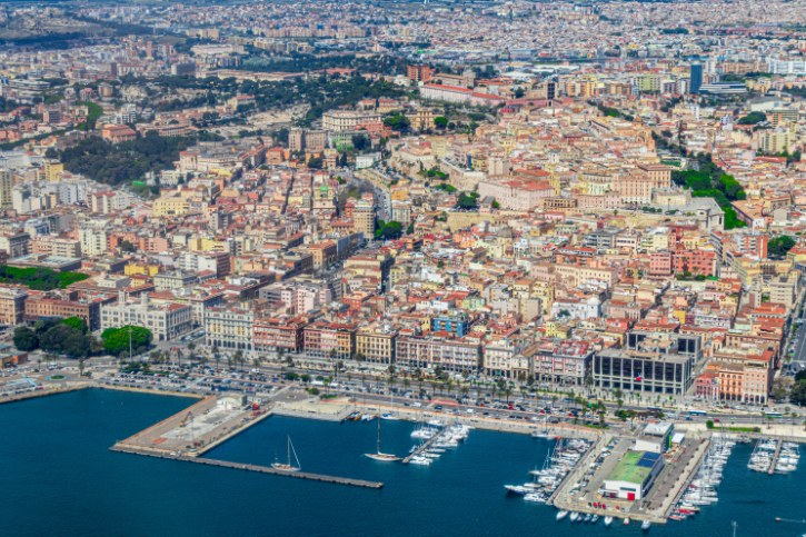
a. The Island’s Lively Capital
Lived in since Phoenician times, Cagliari rises to a hilltop old town called Castello, the one true city on your route and worth a full day.
b. The Historic Heart
- The Torre dell’Elefante, a 1307 Pisan watchtower named for a small carved elephant on its face
- The Torre di San Pancrazio, its slightly older white limestone twin from 1305
- The Bastione di Saint Remy, a grand terrace over the rooftops and port
- The Cathedral of Santa Maria, first consecrated in 1258, blending Pisan, Baroque, and later styles, with a chapel of relics below the altar
c. Culture, Markets, and Neighborhoods
- The Roman Amphitheater, cut into the hillside, once held up to 10,000 spectators
- The National Archaeological Museum, home to the towering Mont’e Prama stone giants and ancient bronzes
- The lively quarters of Marina, Stampace, and Villanova, each with its own character
- The San Benedetto market, its historic hall under renovation, with vendors moved to a modern space in nearby Piazza Nazzari
d. A Beach and Flamingos Within the City
- Poetto Beach, eight kilometers of sand along the city’s edge, backed by the saddle-shaped Sella del Diavolo
- The Molentargius wetland right behind it, home to pink flamingos all year
- A rare treat: ancient streets in the morning, the water in the afternoon
e. Along the Southeast Coast
Leaving the city, the road threads granite headlands and hidden coves until the water turns turquoise near Villasimius.
13. Villasimius
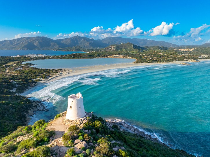
a. Beaches and a Protected Sea
Once a small farming village, Villasimius is now one of the southeast’s loveliest beach spots, built around the Capo Carbonara Marine Protected Area.
b. What the Reserve Protects
- Set up in 1998, the reserve covers over 8,500 hectares of sea around Capo Carbonara
- Vast underwater meadows of Posidonia seagrass that keep the water crystal clear
- Protected species including the noble pen shell, groupers, and loggerhead turtles
- Strict zones where motorboats are banned to leave habitats undisturbed
c. The Beaches You Came For
- Simius Beach, the wide golden stretch nearest the village
- Porto Giunco, a sandy strip beside a lagoon where flamingos feed, topped by an old watchtower
- Punta Molentis, a striking spit of sand with turquoise water on both sides and a summer visitor cap
d. The Town Behind the Sand
- Set slightly inland, Villasimius keeps an easy local feel
- Summer evenings fill the main street with cafés and restaurants
- Try fregula con arselle, toasted pasta pearls cooked with clams
- A small museum shows finds recovered from offshore shipwrecks
e. North to the Red Rocks
The road climbs through hills and river valleys, and the bright bays give way to the deep-red stone of Arbatax.
14. Arbatax
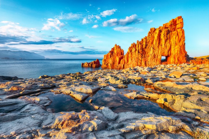
a. The Red Rocks on the Sea
Arbatax is famous for its Rocce Rosse, jagged red rocks of ancient volcanic porphyry rising straight out of the blue-green water, with an easy seaside plaza to take them in.
b. Harbor, Name, and Heritage
- The name comes from Arabic for “fourteen”, a nod to the fourteenth watchtower along the coast
- An old Spanish tower still stands near the water
- Fishermen from the island of Ponza settled here, a heritage you taste in its fish soups
- The Capo Bellavista lighthouse, from 1866, stands on the heights above the town
- The Lido di Orrì unfolds nearby as miles of white sandy coves with shallow, clear water
c. Blue Zone Country
Arbatax sits in Ogliastra, one of the world’s rare “Blue Zones”, known for a traditional diet and unusually long lives, with land wilder and greener than the coasts to the south.
d. Climbing Into Barbagia
The road turns inland, through cork and oak forests and high passes, into Sardinia’s proud mountain interior.
15. Orgosolo
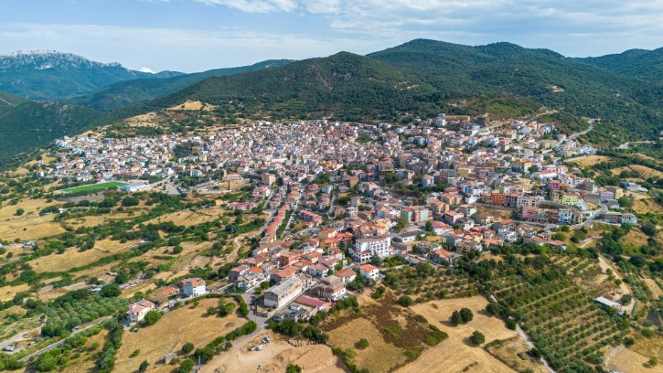
a. The Village of Murals
High in the Barbagia mountains, Orgosolo is known worldwide for its murales, painted walls that turn the village into an open-air gallery, grown from the late 1960s and 1970s to more than three hundred today.
b. What the Walls Are Saying
- The Pratobello revolt, when villagers peacefully stopped the army from seizing their grazing land
- Everyday pastoral life and shepherding
- Women’s rights, world events, and Sardinian poetry
c. Tastes of the Mountains
- Pane carasau, thin, crisp flatbread made to last through long months in the pastures
- Aged pecorino sardo cheese
- Porceddu, roast suckling pig scented with myrtle
- Cantu a Tenore, an ancient four-voice throat singing recognized by UNESCO
d. The Wild Supramonte
- Monte Novo San Giovanni, a peak rising over 1,300 meters
- The Montes forest, home to ancient oaks and Sardinian mouflon
- The honest story of banditry here, best understood as a struggle over land rather than a romantic legend
e. Down to the Gulf of Orosei
The road drops through mountain towns and a tunnel, then hairpins unspool toward the turquoise water of Cala Gonone.
16. Cala Gonone
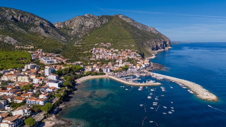
a. Where the Mountains Meet the Sea
Cala Gonone sits at the foot of sheer limestone cliffs on the Gulf of Orosei, your base for a wild coast. One quick note to keep you oriented: it is not at the mouth of the Gorropu Gorge, which lies inland.
b. The Coves and Caves
- Cala Luna, a crescent beach lined with sea caves
- Cala Mariolu, famous for smooth white pebbles and clear turquoise shallows
- Cala Goloritzé, a protected natural monument with a 143-meter rock pinnacle and a natural arch, reached only by hiking and capped each day, with boats kept well offshore
- Grotta del Bue Marino, a vast sea cave named for the monk seals that once sheltered inside
c. The Beaches Close to Town
- Spiaggia Centrale, the town beach by the harbor
- Cala Fuili, a pebble cove and the trailhead for the walk to Cala Luna
- Cala Cartoe and Cala Osalla, sandy beaches a short drive north
d. For the Active Traveler
- World-class rock climbing on limestone sea cliffs
- Diving to underwater caverns and an old shipwreck
- Tiscali, a prehistoric village hidden inside a collapsed sinkhole in the mountains above
- Serra Orrios, a large Nuragic site nearby
- A reminder to check access first, as some sites need authorized guides or permits
e. North to Softer Shores
Heading north, the high cliffs fall away into broad beaches, wetlands, and pine woods on the way to the final stop.
17. San Teodoro
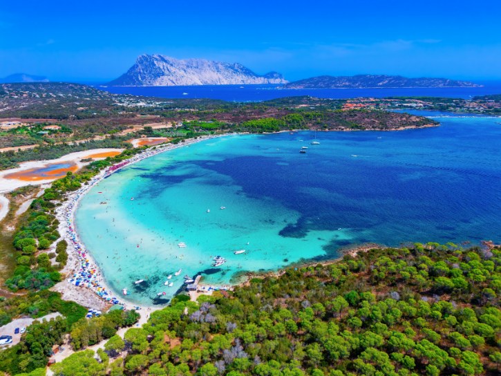
a. A Beach Lover’s Grand Finale
San Teodoro ends the loop with wide beaches and glassy turquoise water:
- La Cinta, a five-kilometer arc of white sand dividing the sea from a lagoon, great for swimming and kitesurfing
- Cala Brandinchi, nicknamed “Little Tahiti” for its shallow, pine-backed bay
- Lu Impostu, a wide sandy crescent just across a low headland
- In the warm months, the two smaller beaches use a booking system with daily limits, so plan ahead
b. The Town and Its Protected Islands
- Summer evenings bring night markets and Gallurese restaurants to the center
- Offshore lies a protected marine area dotted with islands
- Tavolara, a dramatic limestone slab rising 565 meters from the sea, once a tiny self-declared kingdom under the Bertoleoni family
- Molara, a rounded granite island with medieval ruins
- Molarotto, a bare islet kept as a strict reserve for nesting seabirds
c. The Lagoon Behind the Sand
- An important coastal wetland sits behind La Cinta
- It is home to egrets, herons, cormorants, and resident greater flamingos
- Walking paths and birdwatching points let you enjoy it responsibly
d. Closing the Loop
From San Teodoro the road runs straight back to Olbia, closing the circle. After granite peaks, ruins, mining cliffs, and mountain murals, these calm sands and the view out to Tavolara give your trip a gentle finish.
One Island, Many Worlds
Look back on the drive and see how much you packed into a single loop:
- Historic cities and medieval hill towns
- Glamorous resorts and quiet fishing harbors
- Phoenician, Punic, and Roman ruins
- Cliffside mining heritage carved into the rock
- Mountain villages with their own art, music, and food
- Red rocks, white cliffs, and some of the clearest water in the sea
- Protected marine parks, flamingo lagoons, and wild dunes
What holds it together is the steady change beneath your wheels. Granite softens into volcanic hills, then limestone cliffs, then dunes, lagoons, red stone, and highland forest. The history shifts with it, from ancient stone towers to medieval castles, Catalan sea walls, and modern industrial ruins.
That is the real gift of circling Sardinia. Each stop flows into the next, so the whole journey feels like one connected story. Come for the beaches if you like. You will leave having seen a whole small continent.