Southern Italy never repeats itself. One morning you look down on a fishing harbor washed in fading pastels, the next you stand among eroded sandstone spires, then beside a whole city carved into a canyon wall.
Here, beauty comes from the way land, stone, faith and daily life have grown together over three thousand years.
These ten places are worth seeing not just for one photo, but for how landscape and history still shape the everyday atmosphere around them. 😊
1. Procida, Campania: The Intimate, Lived-In Island
a. Why Procida feels different
Procida is small, and that is the point. It covers just over 4 square kilometers of gentle volcanic land, and where nearby Capri leans into tall cliffs and resort life, Procida stays low and real. It was even named Italy’s Capital of Culture in 2022, and tourism authorities now hold it up as a model of slow travel.
b. The visual heart: Marina Corricella
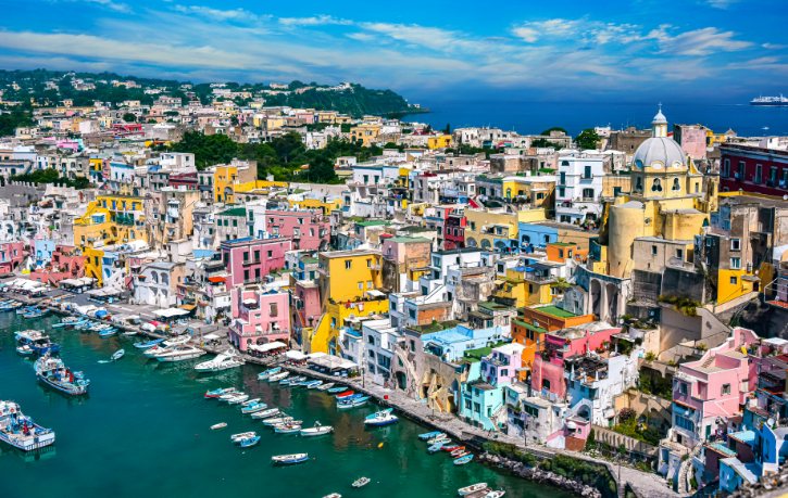
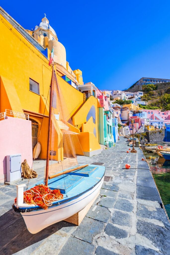
Marina Corricella is the island’s signature, one of the oldest working fishing harbors in the Gulf of Naples.
- Cubic houses, arched loggias and open-air stairways stack straight up a tuff cliff.
- The pastel colors had a purpose: fishermen painted their homes in different shades to spot them from offshore.
- The waterfront is fully pedestrian, with wooden boats and small family trattorie sharing the quay.
c. See it from above, then below
- Piazza dei Martiri gives an elevated view over the whole curve of the harbor.
- Belvedere dei Cannoni, on the climb to Terra Murata, lines the colors up against the sea.
- Then descend the steep vaulted stairways to reach the quay at water level.
Seeing Corricella from above and then from the waterfront is what makes it click. You feel how tightly the community is packed into its cliff.
d. A walk across the island
- Marina Grande, the ferry port, sets the tone with pastel houses and a seafront church.
- Climb to Terra Murata, the medieval fortified quarter on the highest headland.
- Inside stand the Abbey of San Michele Arcangelo and Palazzo d’Avalos, a 1563 fortress that later became a prison until 1988.
- Stepped ramps then bring you down into quiet Corricella.
e. Beaches and wild corners
- Chiaia is black volcanic sand below Terra Murata, reached down 186 steps.
- Pozzo Vecchio is famous as a setting for the film Il Postino.
- Vivara is a protected nature reserve reached by a footbridge, open only by pre-booked guided tour with closed hiking shoes required, so plan ahead.
f. Getting around and how long
- Procida is best explored on foot, though roads are narrow with few pavements.
- Small municipal buses connect the main sights if you want to save your legs.
- A 6 to 8 hour day trip covers the highlights; an overnight lets you enjoy Corricella once the day crowds leave.
g. Pair it with Naples
Combine Procida with Naples, which adds a major historic center, urban culture and the wider Bay of Naples. One tip: do not cram Procida and Capri into the same day, since it undoes the slow pace that makes Procida special.
2. Capri, Campania: Southern Italy’s Spectacular Island Panorama
a. Why Capri earns its place
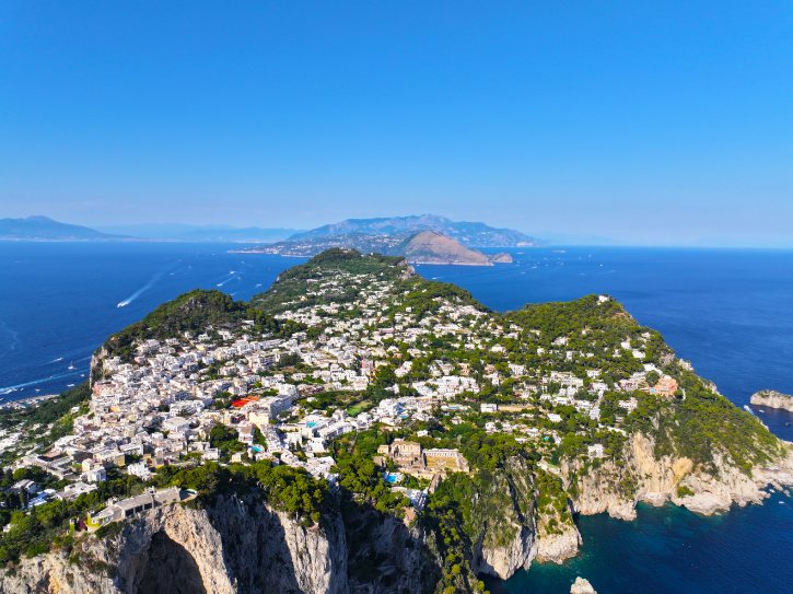
Fame is not the reason Capri belongs here. Its real draw is sheer scale. The island rises straight out of the sea in walls of limestone, topping out at Monte Solaro (589 meters). Everything about it is vertical: white cliffs, the pointed Faraglioni sea stacks, hidden caves and wide viewpoints reaching across the Gulf of Naples.
b. Start in town, then keep moving
- Piazza Umberto I, the “Piazzetta”, is the island’s social heart, framed by a former cathedral and clock tower.
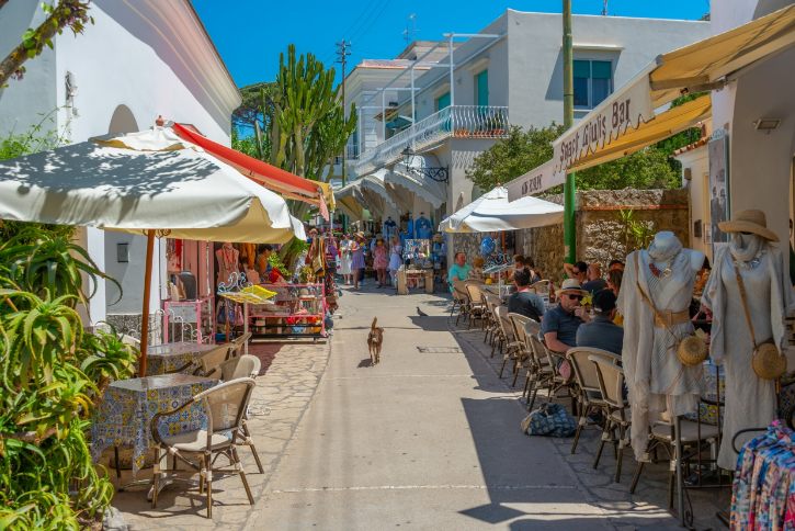
- Beyond the shopping street of Via Camerelle, the town softens into quiet whitewashed lanes and walled gardens.
- Let the walk carry you out toward the scenery. Do not let designer shops define your visit.
c. First big view: Gardens of Augustus
From the Gardens of Augustus you look down on the three Faraglioni and the turquoise water of Marina Piccola. The gardens also overlook Via Krupp, a dramatic switchback path carved into the cliff. Via Krupp has a history of closures for rockfall and now runs on ticketed access, so check its current status before you rely on it.
d. Give Anacapri its own time
- Anacapri is quieter and more craft-minded than Capri town.
- Its Church of San Michele has a famous hand-painted majolica floor.
- Monte Solaro is reached by an open chairlift (about 13 minutes) or an hour’s hike.
- The summit view spans the coast in good weather, but long-distance views depend on clear skies.
e. The sea journey is essential
- A boat trip passes beneath the Faraglioni arch and reaches the White and Green Grottoes.
- The Blue Grotto is entered through an opening barely a meter high, lit an intense blue.
- Access is never guaranteed, as wind, swell and tides force closures. Enjoy the full circumnavigation regardless.
f. A layer of Roman history
Villa Jovis was the grandest villa of Emperor Tiberius, who ran the Roman Empire from Capri between AD 27 and 37. You can still see huge cisterns, terraced halls and a sheer cliff edge. Reaching it takes a 40 to 50 minute uphill walk from the Piazzetta, so confirm it is open before setting off.
g. Making a day work
- Explore Capri as two clusters, Capri town and Anacapri, to avoid endless bus queues.
- For a wilder side, active hikers can walk the Sentiero dei Fortini along the western coast.
- An overnight gives you the island in early morning and evening, once the day crowds are gone. From Monte Solaro, look east toward the Sorrento Peninsula, which leads straight into the Amalfi Coast.
3. Positano and the Amalfi Coast, Campania: The Great Mediterranean Cultural Landscape
a. More than one town
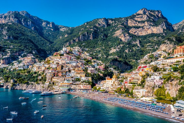
The Amalfi Coast is not a single postcard. It is a UNESCO World Heritage Site, recognized across sixteen towns as an outstanding Mediterranean cultural landscape. What UNESCO values is the balance between steep limestone mountains and centuries of human effort, especially the stone-walled terraces carved for vines, olives and lemons. See it as one connected place, not a string of separate photo stops.
b. Reading Positano
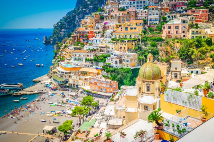
- Cube-shaped houses tumble down slopes of 40 degrees and more toward the beach.
- Notice the whitewashed walls, vaulted roofs and endless staircases.
- The best way to see it is from above to below: start high on the panoramic road, descend on foot through the shaded lanes, and finish at the waterfront.
- Never stop in the road for a photo, as it is narrow and busy.
c. See the coast from above
The Path of the Gods (Sentiero degli Dei) is the finest way to grasp the landscape’s scale.
- It runs from Bomerano along the cliffs to Nocelle, then down a long stairway into Positano.
- It covers about 7.8 kilometers over 3 to 4.5 hours and is rated for hikers, not beginners.
- Wear proper boots and avoid it in storms or fog.
d. Amalfi and Ravello
- Amalfi was an independent maritime republic, and its grand Cathedral of Sant’Andrea, reached up 62 steps, carries an Arab-Norman facade and bronze doors from Constantinople.
- Ravello sits high above and is about looking outward, not down.
- Its Villa Cimbrone ends at the famous Terrace of Infinity, a marble-lined balcony over the Gulf of Salerno.
Keep the contrast in mind: Positano cascades toward the sea, while Ravello opens outward from a height.
e. A few smaller stops
Choose the ones that add real contrast:
- Atrani, Italy’s smallest municipality by area, a tiny knot of vaulted lanes.
- Fiordo di Furore, a deep gorge with a pebble cove reached by about 200 steps; sunlight only reaches the floor for a few midday hours, and the staircase can close for repairs.
- The Lemon Path between Maiori and Minori, winding through terraced groves.
f. Why the terraces matter
Those neat stone terraces are not just scenery. Families built dry-stone walls to hold soil on near-vertical cliffs, then farmed them for generations.
The terraces turned impossible slopes into productive land for vines, olives and the prized local lemons, and they are the reason the coast looks the way it does today. This human-shaped farming is exactly what earned it World Heritage status.
g. Getting around and how long
- The coastal road is narrow and heavily congested from spring through autumn.
- In peak season an alternating license-plate system limits which cars can drive, so ferries between towns are usually the smarter choice.
- Give it two to three days, exploring one manageable cluster at a time rather than everything at once.
4. Castelmezzano and Pietrapertosa, Basilicata: Villages Inside the Lucanian Dolomites
a. A whole new kind of beauty
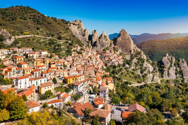
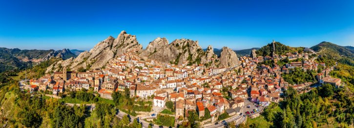
After all that coastline, these two villages are a jolt of something different. They sit deep in the interior of Basilicata, tucked into the Lucanian Dolomites, jagged sandstone peaks inside a regional park. The rock has weathered into dramatic spires that locals name after animals, and two medieval villages sit right inside this natural amphitheater, which is why they belong together.
b. Why Castelmezzano looks extraordinary
- It sits around 750 to 770 meters, cradled in a hollow ringed by sheer walls.
- You reach the historic center through a tunnel cut into the rock.
- Stone houses cluster along steep alleys that end against bare cliff.
- Above the village, a staircase carved into the rock climbs to a Norman-Swabian fortress with valley views.
c. Pietrapertosa, its higher twin
- It is the highest municipality in Basilicata, its upper quarters past 1,080 meters.
- The oldest quarter, the Arabata, is a maze of homes built into rock fissures.
- At the top sits the Saracen Castle, reached by carved rock steps to a natural stone arch.
Where Castelmezzano feels cupped in its rock bowl, Pietrapertosa clings to the summit.
d. The path between them
You can connect the villages on foot rather than driving the mountain road. The Percorso delle Sette Pietre (Path of the Seven Stones) runs about 2 kilometers one way, dropping into a wooded gorge and climbing back up in roughly 1 to 1.5 hours. Along the way, seven art installations draw on local folklore about witches and rural magic.
e. The signature thrill: Volo dell’Angelo
The Volo dell’Angelo (Flight of the Angel) is a pair of zip lines strung between the two villages.
- You fly face-down in a harness at around 110 to 120 km/h.
- One ticket covers both lines plus shuttle buses.
- There are age, weight and height rules, and online booking is required.
- Its seasonal calendar shifts each year, so confirm current dates with the official operator before planning around it.
f. Without the zip line
Plenty here needs no adrenaline:
- Wander the stone lanes of the Arabata quarter.
- Walk the Path of the Seven Stones.
- Climb the rock stairs to the old fortresses.
- Hike into the surrounding oak Forest of Gallipoli Cognato.
g. Practical notes and nearby
- Expect steep cobbled alleys and rock-cut steps, so wear sturdy shoes.
- One full day covers both villages; an overnight lets you see the spires lit at night.
- The best addition nearby is simply more of the regional park, with its scenic drives, forest trails and rock formations.
5. Matera, Basilicata: A City Carved Into Landscape and Time
a. A city and a landscape at once
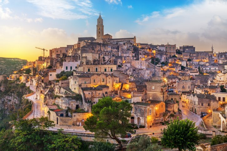
Matera is one of the oldest continuously inhabited places on earth, and a UNESCO World Heritage Site since 1993. What is protected is a whole troglodyte landscape: the Sassi cave districts and the rock churches around them. Carved into soft limestone along a steep canyon, Matera is a woven system of cave homes, rock churches, gardens and underground water channels.
b. Understand what you are looking at
- Civita is the fortified core on a ridge, crowned by the cathedral.
- Sasso Barisano has more built-up facades layered over older caves.
- Sasso Caveoso shows the rawest side, with homes dug straight into the rock.
- Across a deep canyon lie the Gravina gorge and the wild Murgia plateau.
c. A walk built around viewpoints
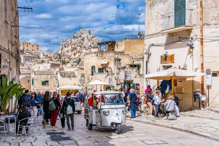
- Piazzetta Pascoli looks over Sasso Caveoso and the Monterrone spire.
- Belvedere Luigi Guerricchio looks into Sasso Barisano toward the cathedral.
- Belvedere di Murgia Timone, across the canyon, gives the full front-on panorama, glowing at dusk.
Choose viewpoints because each explains a different piece of the geography.
d. Go inside the landscape
- A cave-house museum like Casa Grotta shows how families lived with their animals before the 1950s.
- The Palombaro Lungo, a vast rock-cut cistern, is nicknamed the “Subterranean Cathedral”.
- The rock church of Santa Maria de Idris, carved into a spire, holds old Byzantine and Romanesque frescoes.
e. The Murgia and Trail 406
Do not treat the plateau across the canyon as a side trip. It is essential to understanding Matera, showing the ravine, cave systems and rock churches face to face with the city. Active walkers can take Trail 406, which crosses the Gravina on a suspension footbridge. It requires a ticket and sturdy trekking shoes, closes in bad weather, and suits experienced hikers, so confirm current details first.
f. Just enough history
- People have lived here since prehistoric times, building caves, churches and clever water systems.
- By the 1950s the caves were desperately poor, and a 1952 law relocated more than 15,000 residents.
- Decades later, restoration brought the Sassi back, leading to UNESCO status in 1993 and European Capital of Culture in 2019.
g. The best way to see it, and how long
The most complete experience is to see Matera from two sides: from inside the Sassi, and from the Murgia plateau looking back across the ravine. A single day feels rushed, so a day and a half to two days is the sweet spot, ideally staying overnight in a restored cave dwelling to feel the cool, thick-walled quiet firsthand.
6. Polignano a Mare, Puglia: A Town Balanced Over Caves and the Adriatic
a. A town on the edge
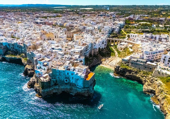
Polignano sits about 24 meters up on a limestone shelf, built right to the cliff edge above the Adriatic. Over ages, the sea has hollowed the rock below into caves and canyons. That tension is the whole appeal: bright white houses balanced over dark, wave-carved caverns, best understood from several angles, including from the water.
b. Start with Lama Monachile
- Lama Monachile (Cala Porto) is a narrow river-carved canyon ending in a cove of white pebbles and turquoise water.
- A stone Bourbon bridge, built on Roman foundations, spans it about 15 meters above the beach.
- The magic is the composition: pebble cove, arched bridge and hanging houses in one view.
c. The old town and a viewpoint route
- Enter from the south through the Arco Marchesale, the last surviving old gate.
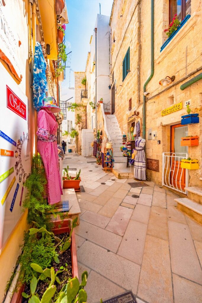
- Inside is a tangle of stone lanes, lime-washed houses and verses painted on the walls.
- Follow a short route of named terraces: the balcony over Lama Monachile, the northern Terrazza Santo Stefano, and Largo Ardito, which looks back at the cliff-top houses.
d. The sea caves
Polignano cannot be fully understood from land, because its foundations are riddled with more than seventy sea caves. The most famous is Grotta Palazzese, a cavern with a terrace high above the water that has hosted banquets since the eighteenth century. Seeing the town by boat shows just how much of it hangs over hollow rock.
e. The real water experiences
- Boat trips into and past the caves.
- Kayaking or paddleboarding when conditions allow.
- Swimming at Lama Monachile or nearby Cala Paura where safe.
The famous cliff-diving event is a spectacle to watch, not something you do yourself, and all water activity depends on calm seas.
f. How long to stay
- Half a day covers the old town, the terraces and Lama Monachile.
- A full day makes sense if you add a boat trip or beach time.
- Midday in July and August brings heavy crowds to the small pebble beach.
g. Pair it with Monopoli
Just 8 kilometers away by a short train ride, Monopoli is a flat, fortified old port with a sixteenth-century castle, a working harbor full of wooden fishing boats and a Baroque cathedral. It complements Polignano’s cliff-edge drama rather than repeating it.
7. Alberobello, Puglia: The Extraordinary Landscape of the Trulli
a. Why it is World Heritage
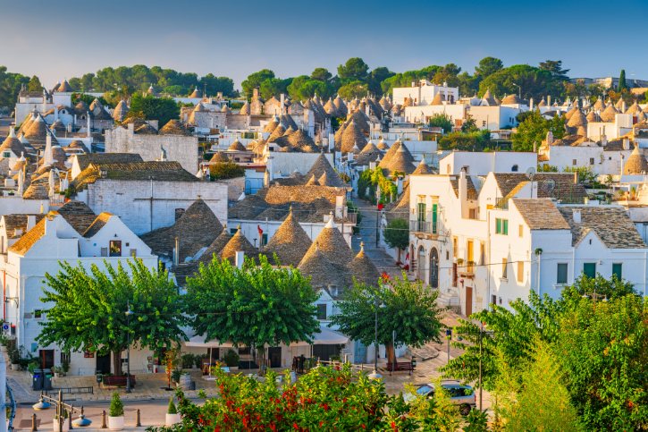
Alberobello holds one of the world’s most complete concentrations of an ancient building method surviving in a real town. A UNESCO World Heritage Site since 1996, it has roughly 1,600 dry-stone conical houses, the trulli, built from local limestone with no mortar at all. What makes it rare is that a simple rural technique was scaled up to build an entire working settlement.
b. What a trullo actually is
- Thick double walls, often 1.5 to 2 meters, keep interiors cool in summer and warm in winter.
- A corbelled roof is laid inward ring by ring, closing at the top with no mortar.
- Thin flat limestone slabs shed the rain, and a carved stone pinnacle tops each cone.
- Rainwater was channeled into cisterns beneath the floor.
You will hear that trulli were built dry so they could be dismantled to dodge a tax. There is a grain of truth there, but the honest reason is a practical response to abundant stone and a hot climate.
c. Two very different districts
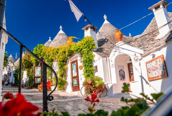
- Rione Monti holds over a thousand trulli but is heavily commercial, lined with shops.
- Rione Aia Piccola has around 400 trulli where families still live, quiet and free of storefronts.
Do not judge the whole site by the busy Monti alone. Aia Piccola shows what it was really like.
d. Read the skyline
Head to Belvedere Santa Lucia in Piazza del Popolo. From this public terrace you look across the little valley straight at the packed stone cones of Rione Monti, the best spot to appreciate Alberobello as one whole architectural landscape rather than a single street.
e. Buildings that explain the rest
- Trullo Sovrano is the only two-story trullo, now a museum, showing how far the technique could go.
- Casa d’Amore was the first house built with mortar, marking the town’s freedom from feudal rule.
- The Church of Sant’Antonio is the only church built in trullo form.
f. Go deeper than souvenirs
To really understand trulli, step inside interpreted ones like the Museo del Territorio “Casa Pezzolla”, a linked complex of fifteen historic trulli. Alberobello wrestles with heavy tourism, so explore respectfully: seek out residential and interpreted areas, and visit early morning or after sunset, when the crowds thin and the cones show their quiet, sculptural side.
g. How long, and where next
- Half a day, about 3 to 4 hours, covers both districts and Trullo Sovrano.
- Pair it with Locorotondo, a circular whitewashed hilltop town about 9 kilometers east with peaked-roof houses and views over the Itria Valley, a sharp contrast to Alberobello’s dark cones.
8. Ostuni, Puglia: The White City Above the Olive Plain
a. Why the setting stands out
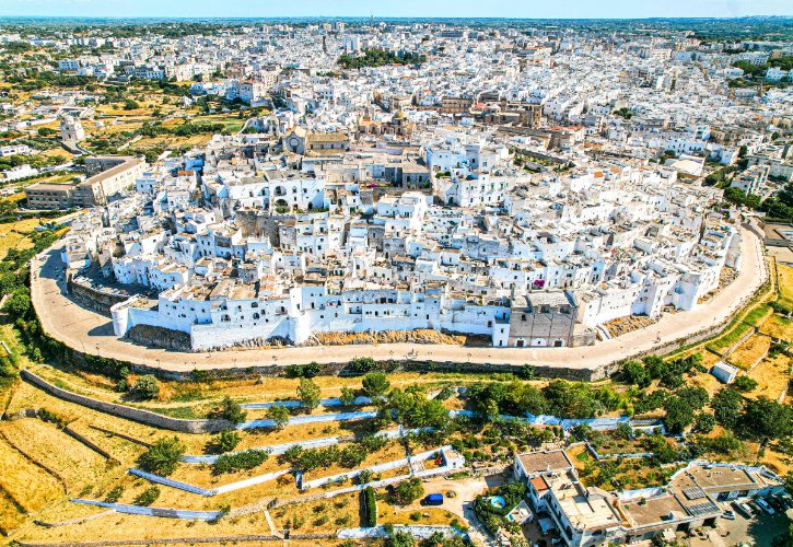
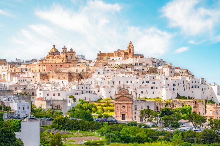
Ostuni, La Città Bianca, rises 218 meters on a limestone hill where the Murge hills meet the coastal plain. Picture three layers stacked together:
- A white stone old town crowned by its cathedral.
- The vast silver-green Plain of Monumental Olive Trees
- The blue line of the Adriatic, about 7 kilometers away.
Keep it clear that the hill town and the coast are two separate places.
b. The climb into “La Terra”
The historic core, La Terra, is a walled citadel shaped by centuries of defense. Experience it as an ascent: enter at the lower square, climb the main lane, then branch into stepped residential alleys spiraling up to the summit. The famous whitewash was practical, used because lime disinfects, brightens the alleys and protects the soft stone, and owners are still required to keep facades white.
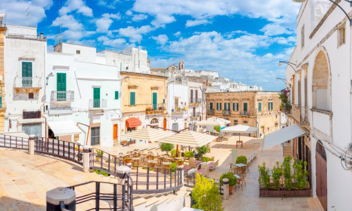
c. The cathedral at the top
- The Cathedral of Santa Maria Assunta was built between 1469 and 1495.
- It is late Gothic, with Venetian and Dalmatian touches, not the ornate Baroque of nearby Lecce.
- Its centerpiece is a huge rose window of 24 stone rays, one of the largest in Europe.
d. Where the views come together
- The white houses of the old town.
- The olive plain rolling toward the coast.
- The Adriatic on the horizon.
That stacking of town, farmland and sea, best seen from terraces near the cathedral, is what gives Ostuni its distinctive look.
e. The olive landscape below
- The plain holds hundreds of thousands of ancient olive trees, many centuries old, twisted into sculptural shapes.
- Scattered across it are fortified farm estates, some with old underground olive presses.
- You can experience it responsibly by visiting a working estate rather than just driving past.
f. The coast and Torre Guaceto
Ostuni’s own coastline lies 7 to 10 kilometers away and is a separate, modern beach zone. For a stronger contrast, head to the Torre Guaceto nature reserve, about 20 kilometers southeast, with sand dunes, clean coves, a historic watchtower and guided snorkeling. Cars are kept out, so you reach the coves on foot, by bike or by shuttle.
g. How long to stay
Half a day is enough for the old town, the cathedral and the views over the plain. A full day makes sense if you add a farm estate visit or an afternoon at Torre Guaceto. Treat this as friendly guidance rather than a fixed plan.
9. Tropea, Calabria: Cliff-Top Old Town, Sanctuary and Tyrrhenian Sea
a. What makes Tropea unforgettable
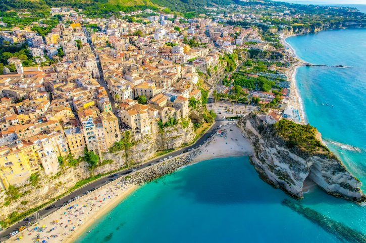
Tropea is Calabria’s showpiece coast, set on the Costa degli Dei (Coast of the Gods). Its identity comes from one dramatic cross-section:
- An old town perched on a 60-meter sandstone cliff.
- White Tyrrhenian beaches directly below.
- An island sanctuary just offshore, linked by a low sandy strip.
- On clear days, distant volcanic islands on the horizon.
b. The old town and its key viewpoint
Start high in the historic center, among seventeenth- and eighteenth-century stone palazzi with carved portals and iron balconies, letting the coast reveal itself as you walk. The essential viewpoint is Largo Migliarese, where a public balustrade hangs over the cliff, taking in the sea, the beach below, the sanctuary rock and, on clear days, distant Stromboli.
c. Down to Santa Maria dell’Isola
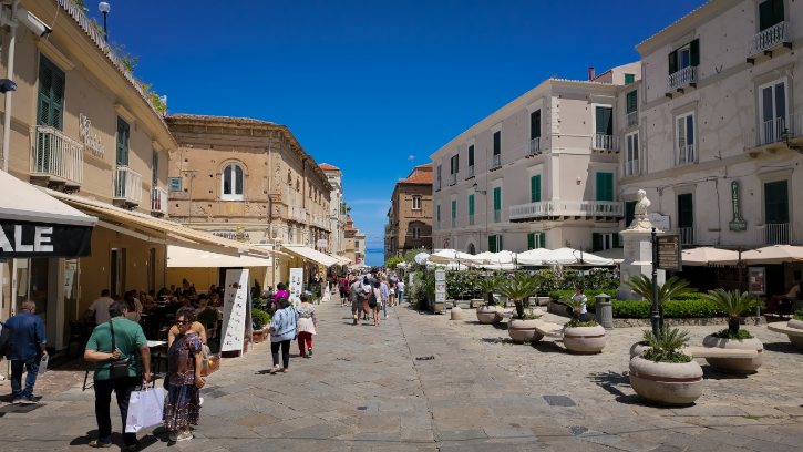
- The Sanctuary of Santa Maria dell’Isola is Tropea’s visual anchor, with roots in early Byzantine and Norman times.
- You reach it by steep stone stairs cut into the cliff, through a terraced garden of olives and cacti.
- Experience it from two directions: looking out at the island from town, then looking back at Tropea’s sheer cliff from the sanctuary.
d. A dose of history
Set back from the cliff, Tropea Cathedral was built in the twelfth century under Norman rule. It holds a revered Byzantine-style painting long credited with protecting the city, and near the entrance two unexploded 1943 bombs are kept as offerings of thanks that the town was spared. Keep this stop short so it complements the coastal scenery.
e. Beaches, chosen for their views
- Spiaggia della Rotonda lies right beneath the central cliff, next to the sanctuary rock, with clear water and white sand.
- Spiaggia del Cannone and ‘A Linguata flank the sanctuary, with shallow water over rocky reefs.
These give you swimming plus constant views back toward the town and the island.
f. Get out on the water and beyond
- A boat trip along the Costa degli Dei passes coves, caves and a sea cave that glows blue, with chances to swim.
- About 9 kilometers southwest, Capo Vaticano shifts to hard granite headlands, with a lighthouse viewpoint and the clear coves of Grotticelle.
- It is a natural continuation of the coast, not just another beach stop.
g. How long to stay
- One full day covers the old town, the sanctuary and a beach.
- One or two nights let you add a boat trip and a sunset at Capo Vaticano.
- As always, marine plans depend on good weather.
10. Taormina, Sicily: Ancient Theatre, Etna and the Ionian Sea
a. A grand finale
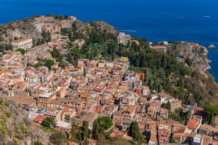
Taormina is the perfect place to end, because it pulls together so many threads of Southern Italy at once. Set 204 meters up on Mount Tauro, it unites Greek and Roman archaeology, a medieval townscape, the Ionian coastline and the looming cone of Mount Etna, Europe’s largest active volcano. The magic is the interaction between all of them.
b. Walk the spine: Corso Umberto
- Enter through Porta Messina, the northern gate.
- Pass Palazzo Corvaja, blending Arab, Norman and later styles.
- Stop at Piazza IX Aprile, the town’s balcony, paved in a checkerboard and ending in a balustrade over the sea toward Etna.
- Continue to the fortified Cathedral of San Nicolò and out through Porta Catania.
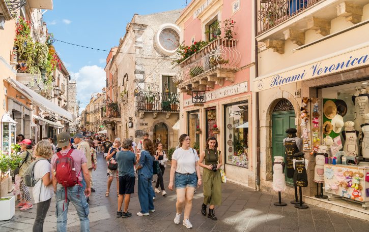
c. The climax: the Ancient Theatre
- The Ancient Theatre was first built by the Greeks, but most of what you see is a Roman reconstruction from the second century AD.
- It is the second-largest ancient theater in Sicily, with much of its Roman stage wall and marble columns still standing.
- The builders placed the stage so its opening frames the coast, the bay and the smoking summit of Etna.
Resist calling the whole structure “Greek”, and check that it is open before you go.
d. Down to the water: Isola Bella
- Isola Bella is a small rocky islet in a turquoise bay, linked to the beach by a strip of sand the waves wash over.
- It became a nature reserve in 1998, with terraced gardens of exotic and native plants.
- It has had repeated closures for cliff stabilization and villa restoration, so check the latest status with the archaeological park before visiting.
e. A two-level town and Castelmola
Taormina has two levels: upper Taormina with the Corso and theatre, and lower coastal Taormina around Isola Bella. Move between them by cable car or a long stone staircase. For a view above them all, ride up to Castelmola, a medieval village on a pinnacle at 529 meters, where Norman castle ruins look down on Taormina, the theatre and the coast toward Etna.
f. Optional add-on: Giardini Naxos
If you have extra time, the seaside town of Giardini Naxos on the bay below was the first Greek colony in Sicily. It offers open sandy beaches, a flat promenade and an archaeological park. Its low coastal setting is a nice change from Taormina’s heights, though Castelmola remains the stronger nearby pairing.
g. How long to stay
- One long day covers the Corso, the Ancient Theatre and a trip down to the bay.
- Two days or an overnight let you add Castelmola, an early-morning visit to the theatre and time on the beaches with Etna in view.
And that is the heart of it. Across every stop on this list, the beauty of Southern Italy comes not from scenery alone, but from the long relationship between people and the land, from harbors and cliffs to caves, terraces and ancient theaters.